How to Find Out If a Neighborhood Is Safe Before You Move
Picking a neighborhood is a deeply personal part of moving. Sure, the house itself is important, but honestly, the streets, the schools, and the block’s vibe at 8 p.m. on a Tuesday shape your life way more than square footage ever will.
Figuring out if a neighborhood is safe before you commit is just practical. Luckily, there are more tools than ever to help you do this.
This article covers how to dig into neighborhood safety, read crime data without panicking, compare areas side by side, and think about safety, along with all the other stuff that makes a place truly livable.
Key Takeaways
- Crime stats are just one piece—combine several sources and go visit if you can.
- Safety can change dramatically from one block to the next, so zoom in closer than city averages.
- The best decisions balance safety with schools, commute, costs, and comfort—not just one thing.
Start With The Right Safety Questions
Before you start scrolling through crime maps or stats, ask yourself what “safe” even means for your life right now.
What Safety Means For Your Daily Life
Safety isn’t one-size-fits-all. Families with kids might care most about walkability and school routes. Remote workers might worry about package theft or parking. If you’re thinking long-term, maybe community stability matters most. Be honest about what you need—otherwise, the data will just overwhelm you.
Why One City Can Contain Very Different Safety Patterns
City-wide crime stats can be pretty misleading. One neighborhood might be super quiet, while another, a few blocks away,y has more incidents. If you only look at city averages, you’re missing the real story.
That’s why it’s worth comparing at the neighborhood level. Two streets in the same zip code can feel like totally different worlds.
How To Compare Areas Without Reducing Them To Labels
It’s tempting to slap a single label on a neighborhood based on reputation, but that’s a shortcut that misses a lot. Places change. Crime patterns shift. New parks, better schools, or local investment can flip the script on an area.
There’s no such thing as a perfect neighborhood. The point is to understand what the numbers say, what they don’t, and if the area fits your comfort zone. That’s where the research actually pays off.
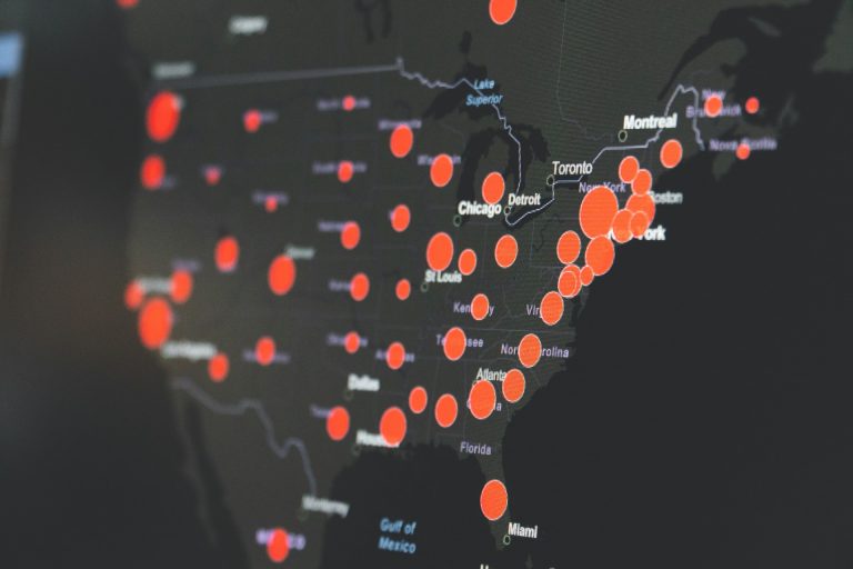
Use Reliable Crime Data Before You Judge A Neighborhood
Once you know what you’re looking for, you can start pulling info from sources that show real numbers—not just rumors.
Where To Find Local Crime Data And Crime Reports
There are a few free tools worth checking out for neighborhood-level crime research.
- SpotCrime gathers public crime reports and puts them on a map, sorted by type and date. You can search by address and even sign up for alerts.
- CrimeGrade.org gives neighborhoods letter grades based on crime data, breaking it down by violent and property crime.
- CityProtect pulls incident data straight from local law enforcement and maps it out.
- CrimeMapping.com works similarly, showing crime data from police departments that choose to share it.
These tools are a starting point, not the final word. The quality depends on what local agencies actually report and how often they do it.
How To Read A Crime Map Without Overreacting To Pins
Crime maps covered in pins can look scary, but context is everything. A bunch of pins in a business district might just mean car break-ins near a parking garage, not that residential streets are dangerous. One random violent incident doesn’t always mean there’s a trend.
Pay attention to the type of incident, how often things happen, and exactly where they happen. If most pins are minor property crimes in one busy block, that’s a different story than repeated incidents across quiet residential streets.
Why FBI Crime Data Explorer, NIBRS, And Local Agency Data Matter
The FBI Crime Data Explorer is probably the most thorough public source for U.S. crime stats. It breaks things down by crime type and reporting area, using info submitted by local police.
The National Incident-Based Reporting System (NIBRS) collects more details per incident than older systems, making it better for comparing neighborhoods. Not every agency participates, and some smaller places might have gaps, so it’s smart to check FBI data against local reports and those neighborhood-level tools for a clearer view.
Look Beyond Crime Stats To Understand Real-World Context
Crime data is just one piece. Whether a neighborhood actually feels good to live in depends on a lot of other things you’ll notice every day.
How School Ratings, Street Conditions, And Daily Activity Add Context
A place with moderate crime stats might still feel calm, well-kept, and friendly. On the flip side, low crime numbers don’t always mean a neighborhood fits your needs.
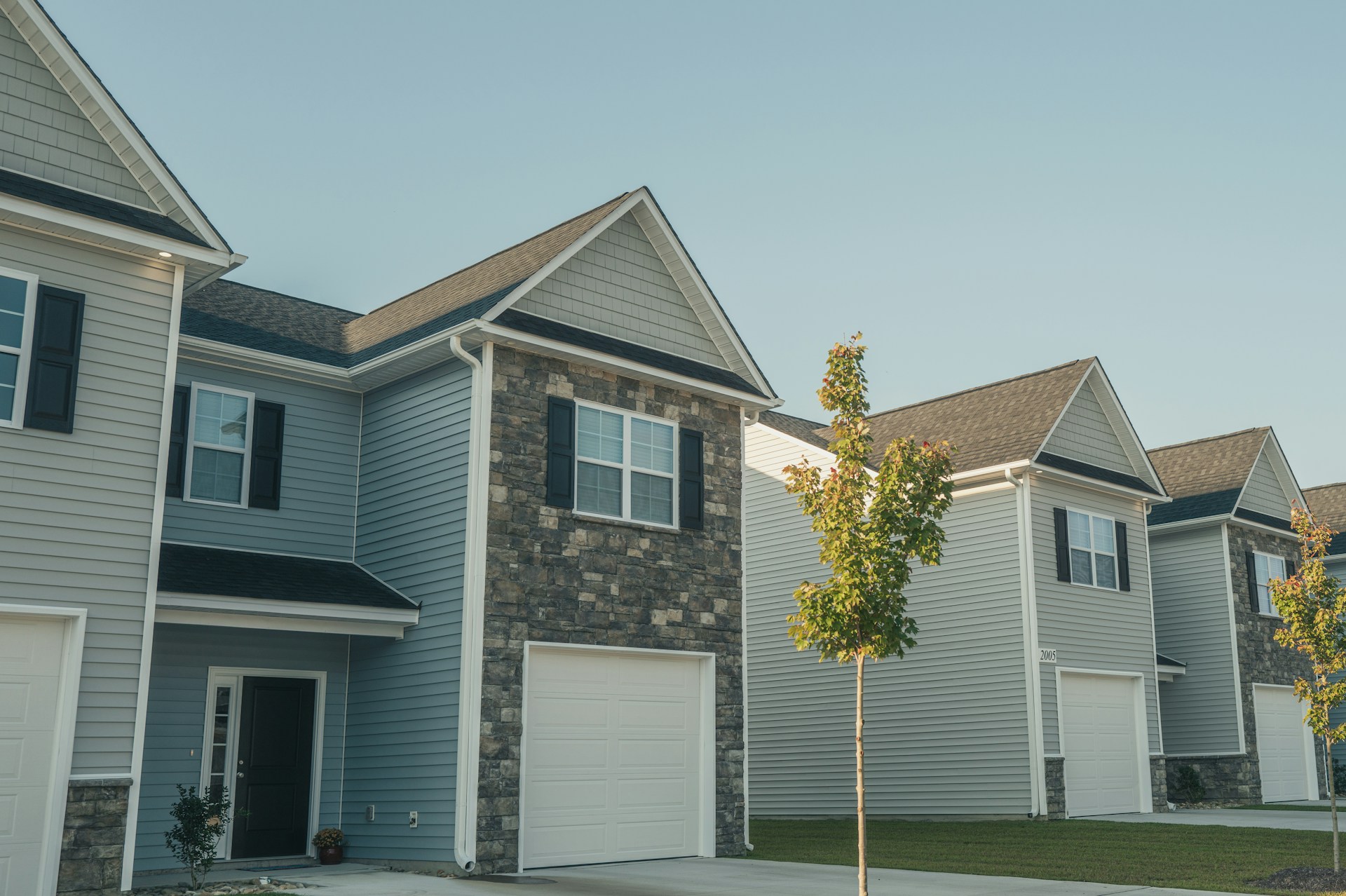
Walk or drive around. Check out sidewalks, lights, parks, and public spaces. Are there people out and about? Are stores open and cared for? Those are signs of a neighborhood with some life to it. School ratings matter too—well-funded, active schools often mean the area is stable long-term.
Why Cost Of Living And Housing Trade-Offs Affect Your Decision
Safety and affordability are usually linked. In most cities, the safest neighborhoods are also the most expensive. You have to weigh that honestly.
Sometimes, a neighborhood with a bit more crime but much lower housing costs can work, especially if you factor in your commute, school access, and how you actually feel there. Your budget sets the boundaries for these trade-offs.
How Livability Scores And AreaVibes Can Support A Broader View
Sites like AreaVibes mix crime data with other stuff—cost of living, schools, health, housing, local amenities—and give each place a composite score. It’s a quick way to compare, but don’t treat it as gospel.
These scores help narrow your search and flag places to check out further. Combine them with your own visits and what locals say for the best results.
Check The Neighborhood In Person And Through Local Signals
Data is helpful, but nothing replaces seeing a place yourself and talking to people who live there.
What To Notice When You Visit At Different Times
Visit any neighborhood you’re serious about at different times—morning, evening, weekends. A quiet morning might not tell you much about what it’s like at 9 p.m. Watch for street activity, lighting, parking, how people interact, and whether things look cared for.
Notice if local businesses are busy, if parks have families, and if you feel comfortable wandering a few blocks. Your own gut feeling counts as data, too.
How Nextdoor And The Neighbors App Can Add Community Insight
Nextdoor is a social platform where neighbors post about local events, safety, lost pets, and all sorts of things. Browsing posts in the area you’re considering can give you a sense of what people there care about.
The Neighbors app from Ring works similarly—it’s a safety alert platform open to anyone, not just Ring users. Residents and police post updates, and you can search any area. Both are helpful, though posts often skew toward problems, not everyday life.
When To Ask Neighbors Or A Local Law Enforcement Agency Questions
If you get the chance, chat with someone who actually lives there—a quick, polite question about how they feel about the area can be surprisingly helpful. Locals usually have a more nuanced view than any website.
You can also reach out to the local police precinct. Many have community liaison officers who’ll talk generally about the area and point you to public safety resources. Not enough people do this, but it can really help clarify things.
Review Sensitive Safety Factors Carefully And Responsibly
Some safety info is sensitive and easy to misinterpret. It’s worth approaching this stuff with a little extra care.
How To Use Registered Offender Databases With Context
Registered sex offender databases are public and searchable by address. They’re legit to check, especially if you have kids, but they’re just one factor—not a reason to instantly rule out a neighborhood.
These registries show legal history, not current risk. One registered person nearby doesn’t automatically mean you’re at higher risk, and an area with none doesn’t guarantee anything. Use this info as a reference, not a final answer.
What Family Watchdog And The National Sex Offender Public Website Show
Family Watchdog is a free map of registered sex offenders by address. You can search any spot, see color-coded icons for offense type, and set up alerts for changes.
The National Sex Offender Public Website (NSOPW) from the DOJ pulls registry data from every state into one searchable database. It’s the most complete national source, and it’s run by the government.
Why Safety Research Should Avoid Assumptions And Fear-Based Conclusions
It’s easy to let safety research turn into fear if you’re not careful. One news story, a single map pin, or an out-of-context stat doesn’t define a neighborhood or your experience living there.
Real research means looking at patterns, comparing lots of factors, and checking your own assumptions. Don’t judge based on demographics, name, or reputation alone. Let the data guide your questions, not just confirm what you already think.
Compare Neighborhoods With A Balanced Decision Framework
Once you’ve pulled together safety info from different sources, the next step is to compare everything side by side so safety becomes just one part of the bigger picture.
Build A Side-By-Side Checklist For Safety, Commute, Schools, And Affordability
Making a checklist helps you go from scattered notes to a clear comparison. For every neighborhood, track the same set of things so you’re not comparing apples to oranges.
| Factor | Neighborhood A | Neighborhood B |
|---|---|---|
| Crime data (type and trend) | ||
| School ratings or district access | ||
| Commute time to work or job site | ||
| Median home price or rent range | ||
| Walkability and street conditions | ||
| Community feel (in-person visit) | ||
| Livability score (AreaVibes or similar) |
This kind of side-by-side comparison makes trade-offs obvious instead of being lost in a dozen browser tabs. If you want to get fancy, a personalized map through SettleSavvy can help you layer all this data visually and compare neighborhoods more efficiently.
When Home Security Steps Make Sense After You Move
No neighborhood is totally risk-free. Once you’ve picked a place and settled in, it just makes sense to take some basic steps for home security, no matter where you end up.
Adding a video doorbell camera helps you see what’s happening outside and might even scare off trouble. If you want more backup, a monitored security system means someone responds if there’s an emergency. This isn’t about thinking your neighborhood’s unsafe—honestly, these are just smart moves for most people living in a house.
Thinking about a monitored system? Take time to compare providers based on your home’s needs, your budget, and how hands-on you want to be. Watch out for hidden fees, confusing contracts, and whether the gear will actually work with what you already have.
Choose Your Next Step With More Confidence
You’ve already done the hard part—digging into the details, walking the blocks, and figuring out what “safe” really means for you. Now, it’s about pulling all that together and deciding what feels right.
Still weighing neighborhoods and want a sharper look at how they compare for safety, schools, the daily drive, or what you can actually afford? Build a Map and watch your priorities come to life in one spot.
If you’re leaning toward a decision but want to talk it through with someone who actually knows the area, Book a Savvy Consultant call and get some real, local advice.
Frequently Asked Questions
What’s the fastest way to check recent crime near a specific address?
SpotCrime and CityProtect let you search by address and filter by date or incident type. For the freshest info, double-check those maps with your local police department’s public portal if they’ve got one.
Which free crime maps are most reliable for comparing neighborhoods?
CrimeGrade.org, SpotCrime, and CrimeMapping.com are all pretty popular. If you want the most official city or region stats, the FBI Crime Data Explorer is your best bet, though you won’t get block-by-block detail there.
What warning signs should I look for when visiting an area in person, day and night?
Look at the state of the streetlights, sidewalks, and public spaces. Notice if businesses are open, if people are out and about at different times, and whether everything seems cared for. If a nighttime walk feels comfortable, that’s a sign you can trust.
How can I compare safety between two neighborhoods using the same set of data?
Stick to the same sources for both places—maybe CrimeGrade.org’s grades, AreaVibes scores, and local police reports. Compare the same time frame, and use a checklist that covers crime types, trends, and how often things happen. That paints a much clearer picture than just one number ever could.
What can a real estate agent legally tell me about crime and safety in the area?
Agents can’t comment on a neighborhood’s demographics because of fair housing laws. But they can steer you to public data and show you tools for your own research. A good local agent usually knows which city or county resources to use, and can help you make sense of what you find.
How accurate are neighborhood safety scores, and what data do they usually miss?
Neighborhood safety scores can help with quick comparisons, but honestly, they’re far from perfect. Most of these scores lean heavily on reported crime data, so they miss out on anything that goes unreported, along with the more informal stuff happening in the community. They also change depending on the time frame and how you draw the map—so it’s all a bit fuzzy. Think of them as a rough guide, not the whole story.